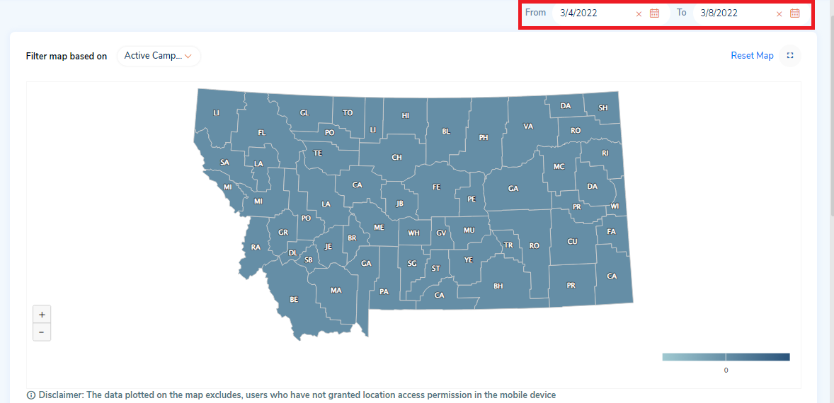
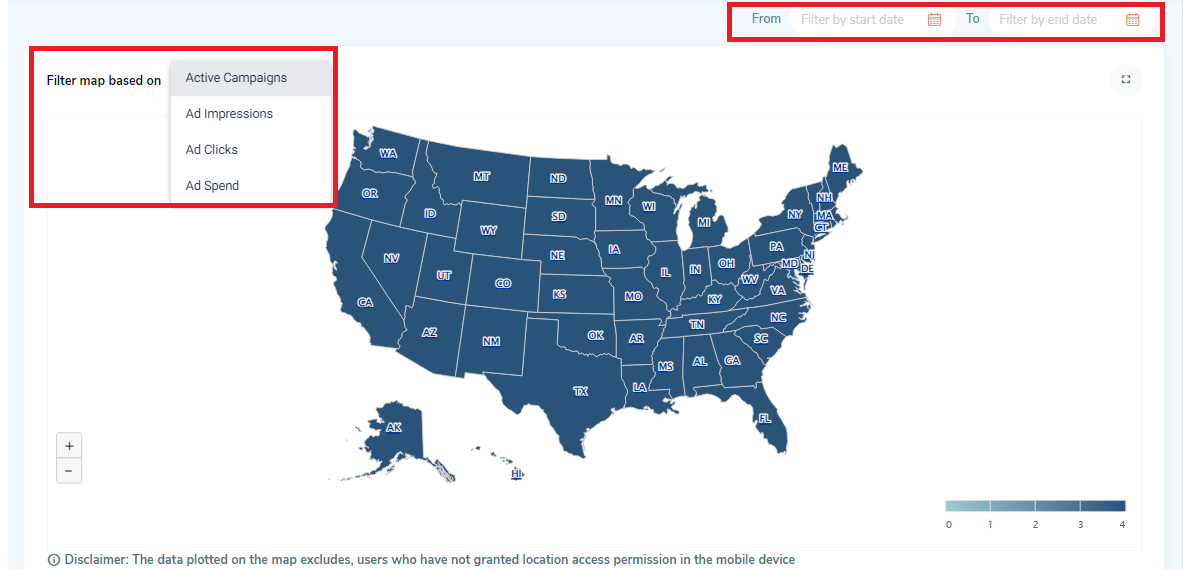
The distribution map is used to represent the distribution of states and shows the count of active campaigns, ad impressions, ad clicks, and ad spend while hovering on the map.
You can filter the map based on the following parameters:
- Filter parameters:
- Active campaigns: Campaigns that are in the active status
- Ad parameters:
- Impressions: Impressions are recorded each time your ad is shown in the Shepherd Shield mobile application.
- Clicks: When the end-user clicks on your ad from the Shepherd Shield mobile application,it will be considered as an ad click.
- Spend: Ad spend is the amount of money you spend on advertising your campaigns.
- Date Range:
- From date
- To date
1. Based on the filter applied, the map will be displayed in the distribution map section.
2. By default, all the states will be displayed on the map.
3. If you select ‘Filter map based on’ as ‘Active Campaigns’ then:
a. You can hover on each state to view the count of active campaigns.
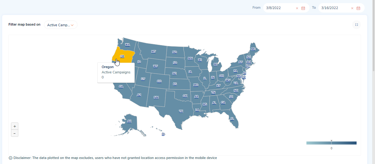
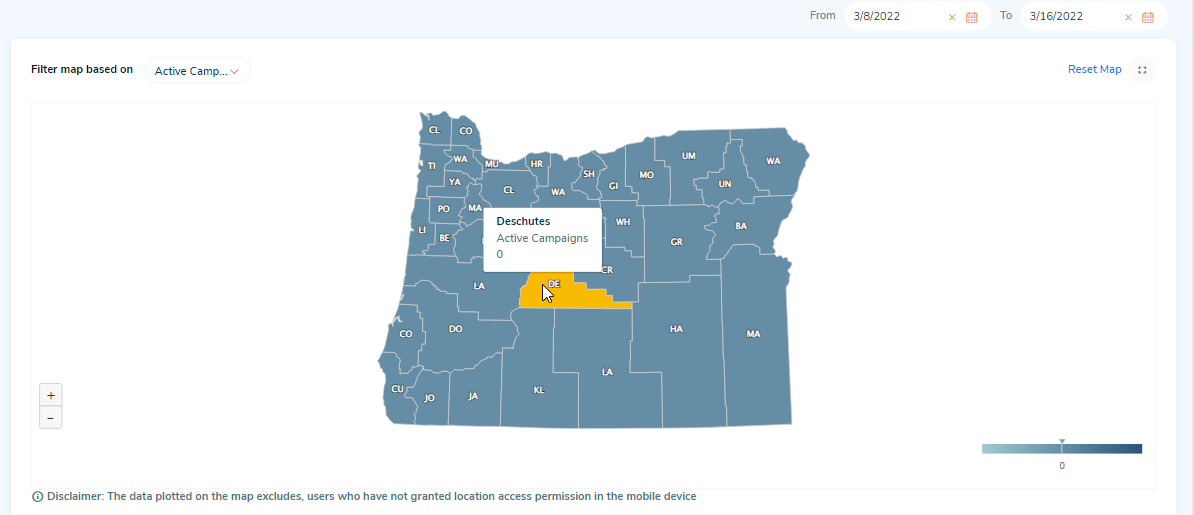
b. You can again click on a state to view the map for the counties of the selected state. Hover the counties to view the count of active campaigns for each county.
4. Similarly, you can view the map of the states and counties based on the respective filter parameters applied.
5. Reset Map: Click on the ‘Reset Map’ button on the top right corner of the distribution map to reset the map to the default view (state-level view).
6. Zoom in and zoom out: Click on the ‘+’ icon on the bottom left of the distribution map, to view the map larger and nearer to you. Click on the ‘-’ icon to view the map smaller and farther.
7. Full Screen mode: Click on the ‘Switch to fullscreen mode’ icon on the top right of the map to view the map in full screen.
8. You can filter the data in the distribution map using the from and to dates.